
Maps and Roads
Historical Maps of Clyde (1857-1937)
To understand the Historical Maps it is helpful to see where Clyde is situated in the bigger picture of the Cranbourne Shire (1860-1994).
Clyde in the Cranbourne Parish (Ward or Riding
The now North Clyde (also the original Clyde) began its development in 1852 with landsales.
When the railway line opened up in 1888, another township developed around the railway station.
Clyde in the Sherwood Parish
Ballarto Road is the northern border of this parish stretching down to Warneet, Tooradin, and Quail Island.
Following land sales beginning about the 1870's eventually the large blocks of land owned by Bakewill were sold via estates. An extension of the Clyde Railway Town took place, particularly after the subdivision of CA Block 38 into housing blocks and the sale of Bailey Estate lands on the souther side of Ballarto Road.
A visual display of this development can be viewed at the following link.
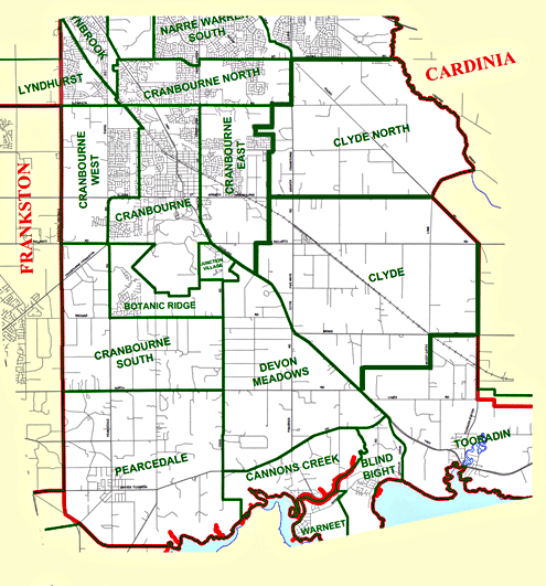
The map below shows how Clyde is spread out in two adjoing parishes of the Cranbourne Shire.
 |
Map Creator: Victoria. Department of Crown Lands and Survey. Modern Clyde within the Casey Shire Council |
 |
1. The Good Country
2. A Clyde History
3. Heritage Council of Victoria
4. Public Records Office Victoria
5. NearMaps
6. Education Department History Unit.
7. State Library Victoria
8. Casey Council website