
Historical Maps of Clyde (1857-1937)
 |
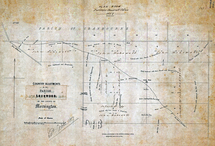
2. Country Allotments, Parish of Sherwood (1857) Clyde, south of Ballarto Road. Surveyors description of the land along with numbered blocks. Shows the track between Tooradin and Cranbourne. Watering hole on the journey is indicated (near end of Moores Rd). No Railway line. |
Country allotments in the Parish of Sherwood, in the County of Mornington [cartographic material] / Victoria ; lithographed at the Surveyor General's Office, Melbourne, March 31, 1857 by T. Ham.
Victoria. Surveyor General's Office
Melbourne : Surveyor General's Office 1857
Interesting features of this map are:
1. No railway line.
2. Descriptions of the land are given eg flowers, trees.
3. The track between Cranbourne and Tooradin
4. Mention of "Field's Water Hole" a possible place of refreshment for man and horse.Also mentioned in an early newspaper article.
5. Early land allotments
To display the entire map:
Click on the following link to see the original in the Victorian State Library
Search.
 |
Source: State Library of Victoria
Creator / Author: Victoria. Surveyor General's Office