
Historical Maps of Clyde (1857-1937)
 |
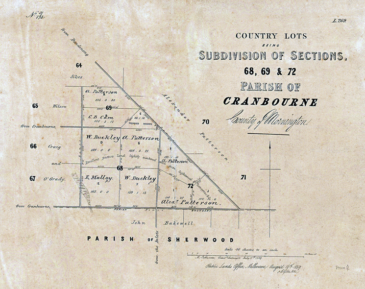
4. Parish of Cranbourne, Subdivisions
(1859) Pound-Ballarto Road. Crown Allotments 68, 69. 72. The west corner of Pound Road and North Ballarto Road. Land sales Lots 68, 69, 72. |
This map shows:
1. The subdivision of a block near to the corner of Ballarto and Pound Rounds.
2. It therefore clarifies ownership making it easier to understand the Cranbourne Shire Rate Book records.
3. Block 68 has been divided among W Buckley, A Patterson and E Malloy
For a copy of the original the reader can open it at the following link.
 |
Source: State Library Victoria
Creator / Author: Victoria Public Lands Office