
 |
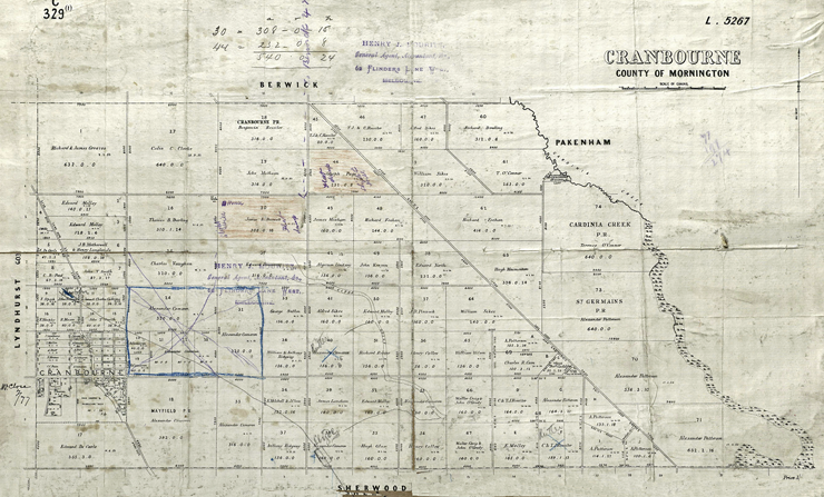
1. Cranbourne, County of Mornington (1859-1860's) Clyde North properties purchased up until 1859. Image is of a damaged map but is more accurate about early land ownership than other similar maps. Map was printed before the railway line was built |
What can we learn from this map?
1. Date properties were purchased
2. Property owners
3. Size of the properties
4. Location of Clyde Creek
5. Road names are not mentioned
6. Largest land owners are Alexander Cameron, Alexander Patterson and Terrence O'Connor.
7. This map was originally owned by Henry J. Mouritz, of 62 Flinders Lane West, Melbourne.
8. The map was printed sometime after 1859 following the October 1859 land sales.
9. First land was purchased on 18th March 1852 by Alexander Cameron and the last blocks were on 24 October 1859 by other buyers.
1. State Library Victoria (SLV)
Map title: Cranbourne, County of Mornington, Date 188-?, Filename ha000957
For more details please open up the map from SLV
 |
| Cleaned version of the same appears below. |
 |
| Sources 1. State Library of Victoria. |